Pioneering Figure|Simulating Landslides to Detect Hidden Risks — Digital Twins Safeguard Slopes
On January 19, 2024, Professor Limin Zhang, Head and Chair Professor of the Department of Civil and Environmental Engineering at The Hong Kong University of Science and Technology (HKUST), and co-founder of STELLERUS TECHNOLOGY LIMITED, was awarded the "National Outstanding Engineer Award" at the Great Hall of the People. The full report is as follows:
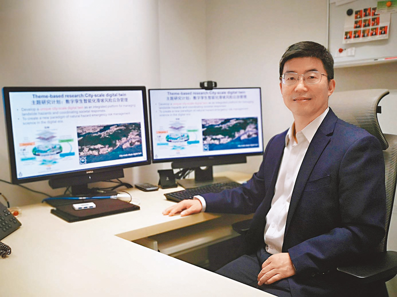
Limin Zhang's team is developing a digital twin system capable of real-time monitoring of all slopes across Hong Kong. (Photo by Wang Dinghuang, Ta Kung Wen Wei Media)
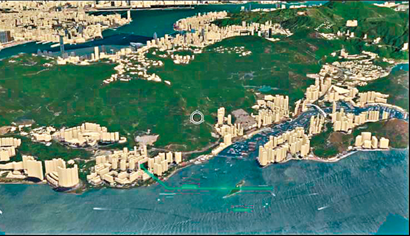
Limin Zhang’s team, in collaboration with government departments including the Geotechnical Engineering Office and the Hong Kong Observatory, has obtained high-resolution maps of all natural slopes, terrain features, and buildings (especially those affected by slopes) across Hong Kong, establishing a city-scale digital twin system for slope monitoring. (Photo courtesy of HKUST)
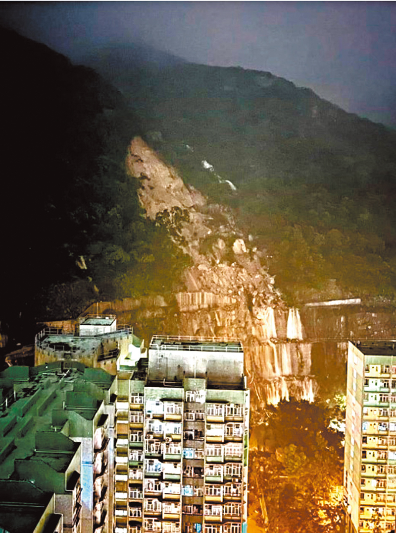
In early September this year, a landslide occurred on the slope near Yiu Hing Road, posing a threat to nearby residential buildings. (File photo)
HKUST Team Develops Slope Monitoring System to Predict Disasters and Support Emergency Decisions Across Hong Kong
Hong Kong, known for its mountainous terrain and dense population, has long faced serious threats from landslides. During the torrential rainstorm on September 7 this year alone, nearly 190 landslide incidents were recorded across the city, disrupting traffic and daily life. In response to the pressing challenge of landslide risk management, Professor Zhang Limin and his team at The Hong Kong University of Science and Technology (HKUST) have been granted nearly HK$74 million by the Research Grants Council (RGC) in 2023 to develop the city’s first city-scale digital twin system capable of covering all slopes in Hong Kong.
In a recent interview with Wen Wei Po, Professor Zhang shared that the project integrates cutting-edge technologies including physics-based simulation models, intelligent sensing, communication-integrated networks, and a digital twin engine. The system will not only enable real-time assessment of landslide risks citywide, but also simulate social responses during disasters—such as traffic congestion and evacuation behavior—thereby enhancing emergency decision-making and supporting “smart disaster mitigation” for Hong Kong.
85% of Deadly Landslides Triggered by Rain or Earthquakes in Past 40 Years
In the past four decades, approximately 85% of deadly landslides worldwide were triggered by heavy rain or earthquakes, resulting in over 180,000 deaths. Since 1984, Hong Kong alone has experienced approximately 13,300 natural slope failures and 8,200 man-made slope landslides, causing significant casualties and economic loss.
“Particularly under the growing threat of extreme weather and strong earthquakes brought by climate change, it is imperative to develop new risk management theories and technologies to ensure public safety and support sustainable development,” said Professor Zhang Limin, Head of the Department of Civil and Environmental Engineering at HKUST and Director of the Geotechnical Centrifuge Facility.
Slope Safety Assessment with Big Data to Identify Risks
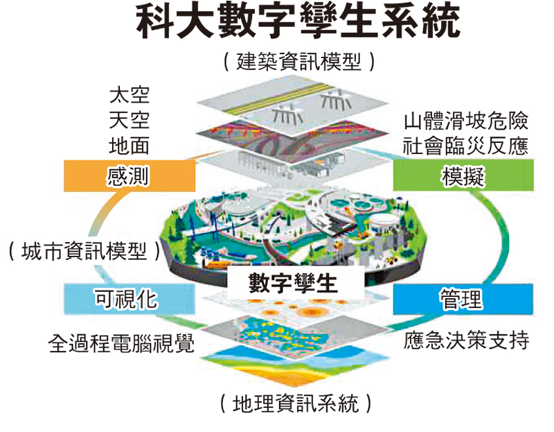
To accurately identify under what conditions each slope across Hong Kong may collapse and to guide reinforcement efforts, Zhang’s team is developing the “AI-Driven Digital Twin System for Intelligent Landslide Risk Emergency Management”. This world-leading system will possess real-time simulation capability and cover all natural and artificial slopes, buildings, as well as rainfall and seismic data citywide.
“It’s like building a digital asset management platform,” Zhang explained. “With this system, we can clearly understand the condition of every slope in Hong Kong.”
The team has partnered with the Geotechnical Engineering Office (GEO), Hong Kong Observatory, and other government agencies to obtain high-resolution maps of Hong Kong’s natural slopes, topography, and buildings (especially those affected by slope conditions), as well as rainfall and seismic records. With the help of optical satellite “HKUST–ALRIS-1” and synthetic aperture radar (SAR) satellites, the team monitors over 60,000 man-made slopes for deformation and displacement. In addition, sensors installed on critical slopes—such as those along Po Shan Road in Mid-Levels—detect deformation and underground water pressure, with data fed into the digital twin system.
“When all this data is transmitted to the system, we can assess the slope’s safety factor and simulate how surrounding buildings would be affected if a landslide occurred,” Zhang noted. “This helps us detect safety vulnerabilities and issue early warnings.”
Simulating Disaster Responses to Strengthen Emergency Preparedness
The system also simulates emergency responses during landslides. “For example, we installed fiber optic sensors on roads near Po Shan Road. When the Observatory issues a black rainstorm warning, we can monitor traffic and pedestrian movement to see if people follow emergency instructions,” said Zhang. These data will be integrated into the system to enable real-time monitoring and information sharing across city districts on roads, rainfall, landslides, and communications—supporting government-led, full-process emergency management.
The digital twin system can also visually demonstrate disaster propagation and human escape responses through 3D computer vision, helping to educate the public on proper disaster response strategies and raise awareness.
“This system can be extended to other disaster scenarios in the future, including earthquakes, floods, typhoons, epidemics, and transportation crises. It will become a general-purpose platform for disaster and crisis management,” Zhang said. His team also plans to collaborate with international geotechnical organizations to promote the standardization of digital twin technologies and support sustainable, resilient disaster mitigation both in Hong Kong and worldwide. (By Wong Ting-wong,Wen Wei Po)
Source: Ta Kung Wen Wei Media
Link: https://bit.ly/44sMWdP